
How Aerial Surveying Helps Improve Site Planning for Large Properties
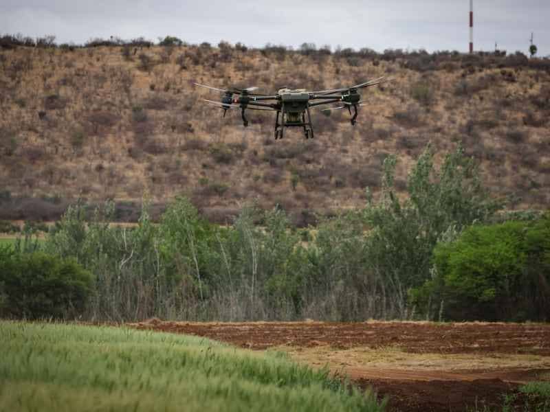
Planning a project on a large property without good data is like designing a house without knowing the size of the lot. You might get lucky. Or you might end up redoing everything once real measurements come in. Aerial surveying solves this early. It gives developers, engineers, and property owners a clear picture of the land before any real design work starts.For large parcels, tracts can stretch across marsh edges, wooded acres, and mixed terrain. Walking the whole site on foot to gather data can take weeks. Aerial surveying covers the same ground in a fraction of the time and gives planners something solid to work from right away.
Creating a Property-Wide Base Map for Early Site Planning
Every site plan starts with a base map. Aerial surveying is one of the fastest ways to build an accurate one for a large property. This map shows the shape of the land, elevation changes, and existing features across the whole parcel.A typical aerial survey base map includes:
Overall property boundaries and general shape
Elevation contours and grade changesExisting plants, tree cover, and cleared areasVisible water features, wetlands, or drainage paths
Roads, buildings, and utility lines already on site
For large properties, this matters because the ground can change fast across one tract. A parcel might have solid ground near the road and low, marsh-like conditions further back. An aerial survey captures that whole picture in one flight. This gives planners a real starting point instead of guesswork based on old maps or assumptions.This base map becomes the layer that every later planning choice gets built on top of.
Why Speed Matters Here
Large properties can take a ground crew days or weeks to map fully on foot. Aerial data collection usually takes a fraction of that time, which keeps early planning moving without long delays.
Identifying Access Routes and Potential Development Areas
Once the base map is done, the next question is usually where building can actually happen and how people will get there. Aerial surveying helps answer both.Aerial data shows patterns that are hard to see from the ground, including:
Natural high ground good for building versus low, wet areas
Existing access points from public roadsPossible routes for new roads or driveways
Areas where tree clearing would be needed versus areas already open
Around Savannah and coastal Chatham County, drainage and flood-prone areas often shape where building can reasonably go. Aerial surveying helps spot these patterns early, before a design team spends time laying out buildings or roads in a spot that turns out to be a bad fit.This doesn’t replace formal flood zone checks or wetland studies, which need their own review. It gives planners a general sense of where those issues are more or less likely to show up.
Connecting Aerial Survey Data With Conceptual Site Design
Aerial data becomes truly useful once it feeds into real site design. Engineers and planners use the base map and elevation data to sketch out where buildings, parking, roads, and utilities could reasonably go.This stage usually involves:
Placing proposed building shapes onto the aerial base map
Testing different site layouts against existing grade and drainageEstimating buildable area after accounting for setbacks and sensitive spots
Spotting rough utility connection points based on visible infrastructure
For large sites, this link between aerial data and design work saves real time. Instead of designing in the abstract and hoping the land works out, planners can test ideas against real site conditions from the start.The design at this stage is still early. It gives the project team a workable direction, not final engineering. More detail gets added as the project moves forward.
Prioritizing Areas That Need Detailed Ground Verification
Aerial surveying gives a strong overview, but it has limits. Thick tree canopy blocks the drone or aircraft sensor from seeing the ground clearly. Some features, like buried utilities or exact boundary markers, simply can’t be seen from the air.This is where aerial data becomes a tool for planning ground work, not a replacement for it. It helps find:
Wooded areas where canopy likely blocks good elevation data
Zones near property lines that need boundary checksSpots where utility checks will be needed before design
Areas the aerial data flags as unusual or off, worth a closer look
Instead of sending a ground crew to walk an entire large property, aerial data helps target where that ground work matters most. This puts time and cost where accuracy really counts.
Why This Combination Works Well
Pairing aerial coverage with targeted ground checks gives a property owner both speed and accuracy. The aerial survey handles the big picture, and ground crews confirm the details that matter most for design and permits.
Using Updated Aerial Surveys Throughout Project Planning
Aerial surveying isn’t just useful at the start of a project. Conditions on a large property can change during planning and construction, and updated flights help keep the data current.Common reasons to update aerial survey data include:
Tracking grading and earthwork progress during construction
Confirming site conditions after clearing or early site workSupporting phased development plans across a large tract
Recording site changes for permits or inspections
For multi-phase projects common on larger properties, updated aerial data helps teams check that construction is matching the approved plan. It also gives lenders, towns, and project teams a clear, current record of site conditions at each stage.Survey and data needs can vary by project size, lender, and town, so confirm what’s needed at each stage of your project. If your project has firm permit or financing deadlines tied to site data, build survey updates into your schedule early.