
Land Surveyor for Mapping Drainage Easements Before Site Expansion
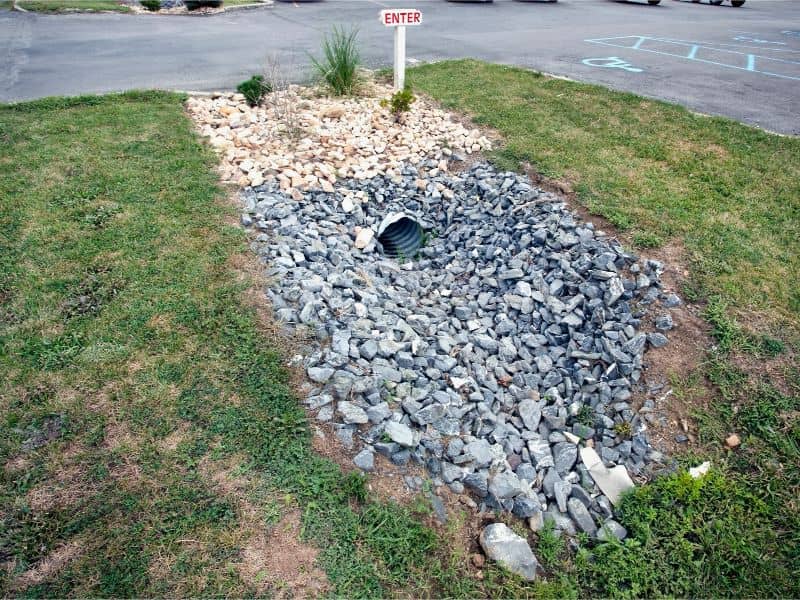
A land surveyor should map drainage easements before you add a building wing, extra parking, or a new storage yard. Drainage easements often run along back property lines, beside parking lots, or across open ground that looks like the perfect spot to grow. Build in the wrong place, and you could block a drainage path, face a stop-work order, or have to tear out new work.
Many owners don’t know an easement exists until a plan reviewer points it out. By then, design fees are spent and the schedule is set. Mapping the easements first lets you plan around them while changes are still cheap.
Why Drainage Easements Matter Before Expanding a Property
A drainage easement gives a city, county, or other party the right to move and manage stormwater across part of your land. It may hold a ditch, swale, pipe, culvert, or pond. You still own the land, but your use of that strip is limited.
Most drainage easements bar permanent buildings and often limit fences, fill, paving, or landscaping that could block flow. The holder may also have the right to enter for maintenance. Exact rules depend on the wording of the recorded document and local codes.
Expansions put pressure on these areas. More roof and pavement means more runoff, and the easement may be part of how that water leaves the site. Knowing where the easement sits helps engineers plan drainage that works for the new layout.
Reviewing Recorded Drainage Easements and Existing Survey Documents
Research comes before field work. A land surveyor reviews deeds, recorded plats, easement agreements, and prior surveys to find every drainage easement tied to the property. Title commitments are a good starting point because they list recorded items that affect the land.
Some easements are clearly drawn with bearings and distances. Others are described loosely, like a strip of a set width centered on an existing ditch. Older documents may refer to features that have moved or no longer exist.
Records to Gather Before the Survey
You can speed up research by pulling together your own records. Even old or partial documents help. Useful items include:
- Your deed and any title commitment or policy
- Recorded plats for the property and nearby lots
- Past surveys, site plans, or drainage studies
Sharing these upfront helps the surveyor know where to look. It can also lower the cost of research time. Ask your title company for copies of any recorded easements they’ve listed.
Locating Drainage Easement Boundaries and Existing Drainage Features
Once the records are reviewed, the surveyor marks where the easement falls on the ground. That starts with finding property corners and lines, since most easement descriptions tie back to them. From there, the easement limits are plotted on the survey map.
A land surveyor also locates the actual drainage features. That includes ditches, swales, inlets, pipes, headwalls, and ponds, along with their elevations. Comparing the recorded easement to what’s on the ground often shows mismatches, like a ditch that wandered outside its strip over the years.
Underground pipes need extra care. Visible structures like manholes and inlets help trace pipe routes, and utility locates may add more detail. Pipe sizes and invert elevations, which are the inside bottom heights of pipes, help engineers judge how much water the system can carry.
Evaluating Easement Locations Against Proposed Building and Site Improvements
With the easements mapped, the design team can test expansion layouts. The survey shows how close a new building, parking area, or loading dock can get without crossing the line. It also shows where grading changes might affect drainage flow.
Overlaps are better found on paper than in the field. If a planned addition crosses an easement, the options may include moving the building, redesigning the drainage, or asking the easement holder about relocation or release. Each path depends on the holder’s approval and local rules.
Setbacks and buffers still apply on top of easement limits. Some codes also require space around stormwater features for access and maintenance. Confirm all of these limits with your engineer and local permit office before final design.
Preparing Survey Maps for Site Expansion Planning and Coordination
The final survey map pulls everything together. It shows property lines, easements, drainage features, buildings, parking, utilities, and elevations on one sheet. Engineers and architects use it as the base for site plans.
Many expansions also need a topographic survey for grading and drainage design. If the site is being financed or sold, a lender may want an ALTA/NSPS survey. Requirements vary by lender, title company, and project scope, so confirm what’s needed early.
Share the map with your engineer, architect, and contractor at the start. One shared base helps everyone design around the same limits. It also gives permit reviewers clear information, which can reduce questions.
Frequently Asked Questions
When should a land surveyor map drainage easements before site expansion?
A land surveyor should map drainage easements before you start design work on an expansion. Early mapping helps you pick a layout that avoids easement conflicts. It also gives engineers time to plan drainage around new buildings and pavement. Waiting until permit review can force costly redesigns.
Can a boundary survey identify drainage easements on a property?
A boundary survey can show recorded drainage easements when the surveyor has the right documents, like a title commitment or recorded plats. The survey plots those easements in relation to property lines. Unrecorded drainage paths may also be shown as observed features. Ask your surveyor to include easements in the scope.
What happens if a proposed building expansion overlaps a drainage easement?
An overlap usually means the design needs to change. Options may include shifting the building, rerouting drainage, or asking the easement holder about relocation or release. Any change to the easement typically needs the holder’s approval and may need a recorded document. Your attorney and engineer can help you weigh the options.
How does a land surveyor locate existing drainage easement boundaries?
The surveyor starts with the recorded easement description and ties it to the property lines on the ground. Then they plot the easement limits on the survey map. They also locate ditches, pipes, and other drainage features nearby. Comparing the two shows whether the easement and the actual drainage line up.
What survey documents are needed before developing land with drainage easements?
Most projects start with a boundary survey that shows recorded easements. A topographic survey adds grades and drainage details for design. Financing may call for an ALTA/NSPS survey. Your title commitment and recorded plats round out the set.